November 53 through December 64 - note that 11 years after the last drought, another one. (sunspots, anyone?)
The first flood that would have touched my foundation (696)
Also, thanks very much to the folks at LCRA for sending me the data so that I could graph it.
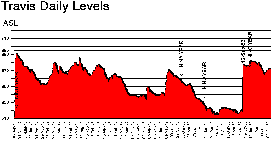
November 53 through December 64 - note that 11 years after the last
drought, another one. (sunspots, anyone?)
The first flood that would have touched my foundation (696)
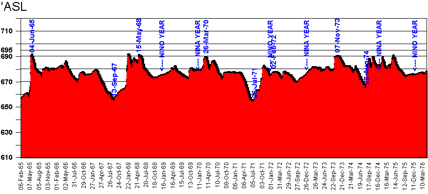
Feb '65 through March of 76 (note no drought in 74?)
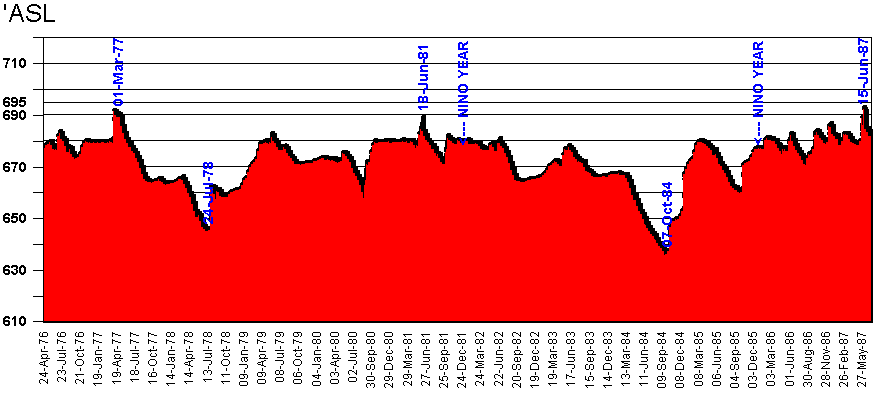
April 76 through March of 87
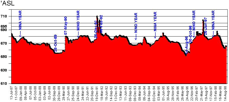
OK, finally we have the floods. 38 years after the first flood,
we have two in a month, then the fourth 5 years later.
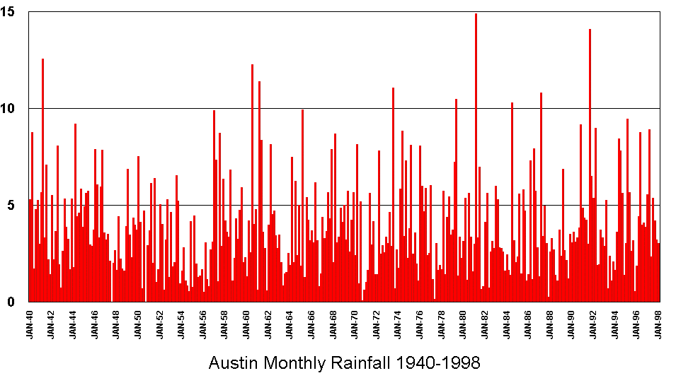
and the entire life of the lake in one graph:
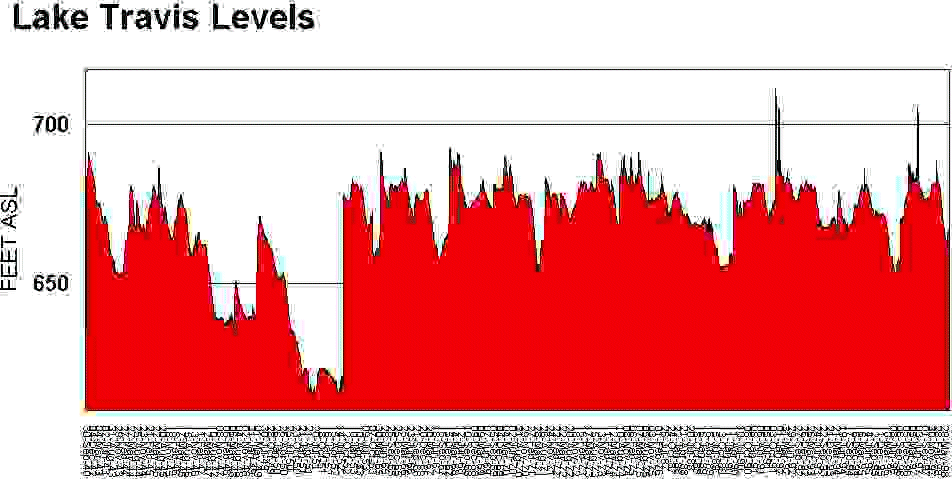
remember, starts in 1940 and goes 59 years forward, to September of
98.
Compare the peaks and troughs with the Austin Monthly Rainfall below:
(Remember that Austin is NOT in the Lake Travis tributary
system)